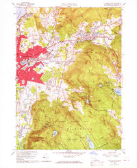
1959 Map of Pittsfield East
USGS Topo · Published 1967About this map
The eastern urban landscape of Pittsfield meets the steep, wooded terrain of the Berkshire Hills in this mid-century survey. The city's industrial and residential density is visible around Silver Lake, giving way to the sprawling Pittsfield Washington Watershed Area and the protected lands of October Mountain State Forest. This transition highlights the critical relationship between the region's urban centers and the high-elevation water sources that sustained them, such as Ashley Reservoir and Farnham Reservoir.
Find a feature on this map
93 named features on this map. Tap any name to fly to it.
Don’t see what you’re looking for? This feature index may not catch every label — zoom into the map to look around manually.
Map Details
Editions of this 1959 Pittsfield East Map
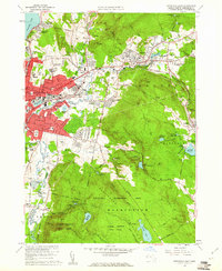
2 editions found
Other maps of this area

1886 · Greylock
USGS Topo · 1:62,500

1886 · Becket
USGS Topo · 1:62,500

1888 · Becket
USGS Topo · 1:62,500

1888 · Berlin
USGS Topo · 1:62,500

1888 · Pittsfield
USGS Topo · 1:62,500

1890 · Pittsfield
USGS Topo · 1:62,500

1890 · Berlin
USGS Topo · 1:62,500

1891 · Greylock
USGS Topo · 1:62,500

1893 · Becket
USGS Topo · 1:62,500

1893 · Greylock
USGS Topo · 1:62,500