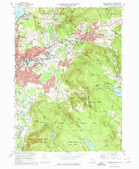
1973 Map of Pittsfield East
USGS Topo · Published 1975About this map
The East Branch Housatonic River carves through this Berkshire County landscape, defining the industrial and residential corridors of Pittsfield, Dalton, and Hinsdale during the early 1970s. The urban center of Pittsfield is dense with institutional landmarks, from the St Lukes Hospital and the county Jail to a high concentration of neighborhood schools like the Rice Sch and Mercer Sch. This era captures the city's growth toward the northeast at Coltsville and the residential clusters of Lakeview Terrace near the shores of Pontoosuc Lake.
Find a feature on this map
143 named features on this map. Tap any name to fly to it.
Don’t see what you’re looking for? This feature index may not catch every label — zoom into the map to look around manually.
Map Details
Editions of this 1973 Pittsfield East Map
2 editions found
Other maps of this area

1886 · Greylock
USGS Topo · 1:62,500

1886 · Becket
USGS Topo · 1:62,500

1888 · Becket
USGS Topo · 1:62,500

1888 · Berlin
USGS Topo · 1:62,500

1888 · Pittsfield
USGS Topo · 1:62,500

1890 · Pittsfield
USGS Topo · 1:62,500

1890 · Berlin
USGS Topo · 1:62,500

1891 · Greylock
USGS Topo · 1:62,500

1893 · Becket
USGS Topo · 1:62,500

1893 · Greylock
USGS Topo · 1:62,500