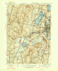
1947 Map of Pittsfield West
USGS Topo · Published 1947About this map
The industrial and community landscape of the Berkshires unfolds across this mid-century survey, centered on the western expansion of Pittsfield. To the west, the historic Shaker Village stands near the foot of Shaker Mtn, marking a distinct communal settlement pattern that contrasts with the developing residential grid of the city. The Boston and Albany Railroad serves as a vital corridor through the valley, passing near West Pittsfield and the waters of Richmond Pond.
Find a feature on this map
63 named features on this map. Tap any name to fly to it.
Don’t see what you’re looking for? This feature index may not catch every label — zoom into the map to look around manually.
Map Details
Editions of this 1947 Pittsfield West Map
2 editions found
Other maps of this area

1886 · Greylock
USGS Topo · 1:62,500

1886 · Becket
USGS Topo · 1:62,500

1888 · Becket
USGS Topo · 1:62,500

1888 · Berlin
USGS Topo · 1:62,500

1888 · Pittsfield
USGS Topo · 1:62,500

1890 · Pittsfield
USGS Topo · 1:62,500

1890 · Berlin
USGS Topo · 1:62,500

1891 · Greylock
USGS Topo · 1:62,500

1893 · Becket
USGS Topo · 1:62,500

1893 · Greylock
USGS Topo · 1:62,500