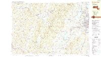
1988 Map of Pittsfield West
USGS Topo · Published 1988About this map
The Taconic Range and the western edge of Pittsfield anchor this late-1980s landscape at the Massachusetts and New York border. The transition from the urban density of the city to the peaks of Pittsfield State Forest is striking, showing a mix of industrial infrastructure and recreation. Large water bodies like Onota Lake and Pontoosuc Lake dominate the eastern valley, while the western side features a string of Lebanon-named settlements including West Lebanon and Lebanon Springs along the Wyomanock Creek.
Find a feature on this map
85 named features on this map. Tap any name to fly to it.
Don’t see what you’re looking for? This feature index may not catch every label — zoom into the map to look around manually.
Map Details
Editions of this 1988 Pittsfield West Map
2 editions found
Other maps of this area

1886 · Greylock
USGS Topo · 1:62,500

1886 · Becket
USGS Topo · 1:62,500

1888 · Becket
USGS Topo · 1:62,500

1888 · Berlin
USGS Topo · 1:62,500

1888 · Pittsfield
USGS Topo · 1:62,500

1890 · Pittsfield
USGS Topo · 1:62,500

1890 · Berlin
USGS Topo · 1:62,500

1891 · Greylock
USGS Topo · 1:62,500

1893 · Troy
USGS Topo · 1:62,500

1893 · Becket
USGS Topo · 1:62,500