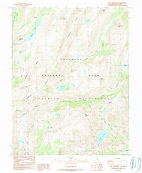
1990 Map of Piute Mountain
USGS Topo · Published 1990About this map
Yosemite National Park dominates this high-altitude landscape in the Sierra Nevada, where glaciated canyons and massive peaks define the terrain as it was documented in 1990. The north-to-south passage of the Pacific Crest National Scenic Trail winds through the heart of the Yosemite Wilderness, crossing significant elevations at Seavey Pass. This survey illustrates the intricate drainage network of the high country, including the headwaters of Piute Creek and Rancheria Creek, which carve deep through Stubblefield Canyon and Thompson Canyon. The presence of substantial water bodies like Tilden Lake and Benson Lake provides a clear view of the basin morphology, while prominent landmarks such as Piute Mountain and Chittenden Peak anchor the topographical study of this protected wilderness area.
Find a feature on this map
26 named features on this map. Tap any name to fly to it.
Don’t see what you’re looking for? This feature index may not catch every label — zoom into the map to look around manually.
Map Details
Editions of this 1990 Piute Mountain Map
This is the sole edition of this map. No revisions or reprints were ever made.
Other maps of this area

1896 · Dardanelles
USGS Topo · 1:125,000

1897 · Yosemite
USGS Topo · 1:125,000

1898 · Dardanelles
USGS Topo · 1:125,000

1900 · Yosemite
USGS Topo · 1:125,000

1901 · Mt. Lyell
USGS Topo · 1:125,000

1903 · Yosemite
USGS Topo · 1:125,000

1909 · Yosemite
USGS Topo · 1:125,000

1909 · Bridgeport
USGS Topo · 1:125,000

1911 · Bridgeport
USGS Topo · 1:125,000

1920 · Bridgeport
USGS Topo · 1:125,000