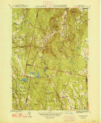
1948 Map of Plainfield
USGS Topo · Published 1948About this map
Hawks Mountain and Mt Peak dominate the high terrain where the borders of Berkshire, Franklin, and Hampshire counties converge. This 1940s landscape is defined by the headwaters of the Chickley River and the Westfield River, with isolated rural life clustered around small settlements like West Hawley and Plainfield. The mapping shows a persistent network of dirt and unpaved roads connecting family-named landmarks and local institutions, such as Bozrah Sch and Hilltop Cem.
Find a feature on this map
81 named features on this map. Tap any name to fly to it.
Don’t see what you’re looking for? This feature index may not catch every label — zoom into the map to look around manually.
Map Details
Editions of this 1948 Plainfield Map
2 editions found
Other maps of this area

1886 · Greylock
USGS Topo · 1:62,500

1886 · Hawley
USGS Topo · 1:62,500

1886 · Chesterfield
USGS Topo · 1:62,500

1886 · Becket
USGS Topo · 1:62,500

1888 · Becket
USGS Topo · 1:62,500

1888 · Chesterfield
USGS Topo · 1:62,500

1890 · Hawley
USGS Topo · 1:62,500

1891 · Greylock
USGS Topo · 1:62,500

1893 · Chesterfield
USGS Topo · 1:62,500

1893 · Becket
USGS Topo · 1:62,500