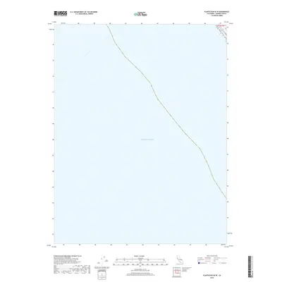
2018 Map of Plantation OE W
USGS Topo · Published 2018About this map
The Pacific Ocean dominates this coastal survey along the Sonoma County shoreline. This particular sheet captures the transition from land to sea, with the maritime boundary and the Public Land Survey System demarcation of t11n r15w serving as the primary geographic markers. The coastline itself is defined by steep contours that descend rapidly into the deep waters of the Pacific, reflecting the dramatic geology characteristic of this stretch of northern California. While largely a marine-focused study, it provides precise documentation of the shoreline's position in 2018.
Find a feature on this map
2 named features on this map. Tap any name to fly to it.
Don’t see what you’re looking for? This feature index may not catch every label — zoom into the map to look around manually.
Map Details
Editions of this 2018 Plantation OE W Map
This is the sole edition of this map. No revisions or reprints were ever made.
Other maps of this area

1921 · Plantation
USGS Topo · 1:62,500

1943 · Stewarts Point
USGS Topo · 1:24,000

1943 · Plantation
USGS Topo · 1:24,000

1943 · Annapolis
USGS Topo · 1:24,000

1944 · Annapolis
USGS Topo · 1:31,680
1944 · Plantation
USGS Topo · 1:31,680

1944 · Stewarts Point
USGS Topo · 1:31,680

1947 · Santa Rosa
USGS Topo · 1:250,000

1949 · Santa Rosa
USGS Topo · 1:250,000

1958 · Santa Rosa
USGS Topo · 1:250,000