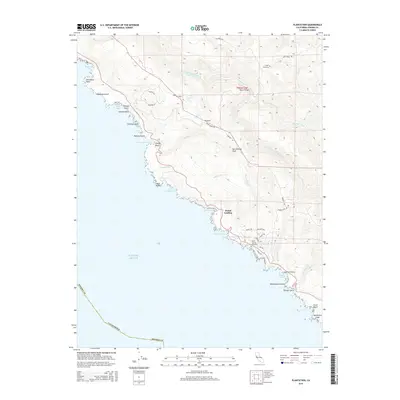
2015 Map of Plantation
USGS Topo · Published 2015About this map
The San Andreas Fault cuts a distinctive diagonal path through this coastal stretch of Sonoma County, defining the drainage patterns of the South Fork Gualala River and its numerous tributaries. High on the ridges, the settlement of Plantation sits near Lake Oliver and Lake Lower, while the coastline below is a succession of rocky coves and points, including Gerstle Cove, Horseshoe Cove, and the prominent Salt Point.
Find a feature on this map
56 named features on this map. Tap any name to fly to it.
Don’t see what you’re looking for? This feature index may not catch every label — zoom into the map to look around manually.
Map Details
Editions of this 2015 Plantation Map
This is the sole edition of this map. No revisions or reprints were ever made.
Other maps of this area

1921 · Skaggs
USGS Topo · 1:62,500

1921 · Plantation
USGS Topo · 1:62,500

1942 · Arched Rock
USGS Topo · 1:24,000

1943 · Tombs Creek
USGS Topo · 1:24,000

1943 · Stewarts Point
USGS Topo · 1:24,000

1943 · Plantation
USGS Topo · 1:24,000

1943 · Annapolis
USGS Topo · 1:24,000

1943 · Fort Ross
USGS Topo · 1:24,000
1944 · Fort Ross
USGS Topo · 1:31,680

1944 · Annapolis
USGS Topo · 1:31,680