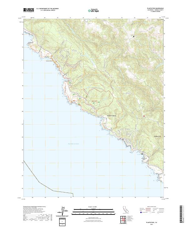
2021 Map of Plantation
USGS Topo · Published 2021About this map
Timber Cove and Walsh Landing anchor this coastal reach where the Pacific meets the northern California uplands. The landscape is defined by an intricate network of gulches and coves, from Horseshoe Cove in the north down to Stillwater Cove and the jagged edge of Windermere Point. Inland, the terrain rises toward Skyline Ridge, drained by the South Fork Gualala River and numerous creeks like Wildcat Cr and Stockhoff Cr. This 2021 survey documents a dense system of modern roads and trails, including the Salt Point Forest Loop Trail Route Trl and Plantation Trl Trl, which navigate the steep topography between the shore and the ridgelines. Family and ranch history is preserved in the landscape through sites such as Benitz Ranch Cem, Cooper Cem, and Thomas Cem, marking early land use along this isolated stretch of the Sonoma coastline.
Find a feature on this map
73 named features on this map. Tap any name to fly to it.
Don’t see what you’re looking for? This feature index may not catch every label — zoom into the map to look around manually.
Map Details
Editions of this 2021 Plantation Map
This is the sole edition of this map. No revisions or reprints were ever made.
Other maps of this area

1921 · Skaggs
USGS Topo · 1:62,500

1921 · Plantation
USGS Topo · 1:62,500

1942 · Arched Rock
USGS Topo · 1:24,000

1943 · Tombs Creek
USGS Topo · 1:24,000

1943 · Stewarts Point
USGS Topo · 1:24,000

1943 · Plantation
USGS Topo · 1:24,000

1943 · Annapolis
USGS Topo · 1:24,000

1943 · Fort Ross
USGS Topo · 1:24,000
1944 · Fort Ross
USGS Topo · 1:31,680

1944 · Annapolis
USGS Topo · 1:31,680