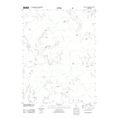
2012 Map of Plaskett Ridge
USGS Topo · Published 2012About this map
The Black Butte River carves a deep path through this section of the Mendocino National Forest, serving as a central axis for a landscape defined by sharp ridges and isolated homesteads. Named clearings and historical sites like Carpenter Place, Keller Place, and Hays Place are scattered across the high ground, suggesting a legacy of early ranching or mountain habitation. The terrain is structured by prominent elevations including Plaskett Ridge and Pinto Ridge, with higher peaks like Little Baldy and Umbrella Butte marking the southern reaches.
Find a feature on this map
62 named features on this map. Tap any name to fly to it.
Don’t see what you’re looking for? This feature index may not catch every label — zoom into the map to look around manually.
Map Details
Editions of this 2012 Plaskett Ridge Map
This is the sole edition of this map. No revisions or reprints were ever made.
Other maps of this area

1926 · Covelo
USGS Topo · 1:62,500

1929 · Eden Valley
USGS Topo · 1:62,500

1952 · Hull Mountain
USGS Topo · 1:62,500

1952 · Eden Valley
USGS Topo · 1:62,500

1952 · Covelo
USGS Topo · 1:62,500

1952 · Anthony Peak
USGS Topo · 1:62,500

1957 · Ukiah
USGS Topo · 1:250,000

1960 · Ukiah
USGS Topo · 1:250,000
1966 · Sanhedrin Mtn
USGS Topo · 1:24,000

1967 · Plaskett Ridge
USGS Topo · 1:24,000