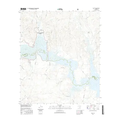
2016 Map of Platt
USGS Topo · Published 2016About this map
The Sam Rayburn Reservoir dominates the eastern half of this landscape, its fingers reaching into the lowlands along the boundary of Angelina National Forest. This section of East Texas is defined by a dense network of drainages and wetlands, including the extensive Boggy Slough and Board Tree Slough near the center of the sheet. The settlement at Platt sits near the western edge, connected to the surrounding countryside by roads such as Saints Rest Rd and Hightower Rd. Local history and genealogy interests are centered on the Jacob Chapel Cem in the northeast and family-named landmarks like Marions Ferry Rd and ID Anderson Rd. The map illustrates the hydrological complexity of the area where Moccasin Cr and Dorr Cr feed into the larger reservoir system.
Find a feature on this map
52 named features on this map. Tap any name to fly to it.
Don’t see what you’re looking for? This feature index may not catch every label — zoom into the map to look around manually.
Map Details
Editions of this 2016 Platt Map
This is the sole edition of this map. No revisions or reprints were ever made.
Other maps of this area

1949 · Lufkin
USGS Topo · 1:62,500

1949 · Platt
USGS Topo · 1:24,000

1949 · Lufkin
USGS Topo · 1:24,000

1949 · Huntington
USGS Topo · 1:24,000

1950 · Platt
USGS Topo · 1:24,000

1950 · Lufkin
USGS Topo · 1:24,000

1950 · Redland
USGS Topo · 1:24,000

1950 · Huntington
USGS Topo · 1:24,000

1952 · Nacogdoches
USGS Topo · 1:62,500

1953 · Palestine
USGS Topo · 1:250,000