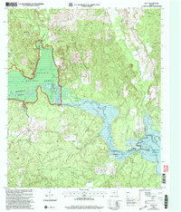
2003 Map of Platt
USGS Topo · Published 2004About this map
The Angelina River and the expanding waters of the Sam Rayburn Reservoir dominate this landscape on the boundary of Nacogdoches and Angelina Counties. The 2003 revision reveals a region defined by its timber and water resources, with much of the northern and central terrain protected within the Angelina National Forest. Small rural settlements like Platt serve as quiet anchors in an area crisscrossed by numerous seasonal waterways, including Boggy Slough and Board Tree Slough. Cultural landmarks such as Victory Ch and Saints Rest Ch are scattered throughout the wooded uplands, providing valuable points of reference for local family history. The presence of a significant pipeline and the utility-focused Water Well Road illustrates the modern infrastructure integrated into this heavily forested East Texas environment.
Find a feature on this map
24 named features on this map. Tap any name to fly to it.
Don’t see what you’re looking for? This feature index may not catch every label — zoom into the map to look around manually.
Map Details
Editions of this 2003 Platt Map
This is the sole edition of this map. No revisions or reprints were ever made.
Other maps of this area

1949 · Lufkin
USGS Topo · 1:62,500

1949 · Platt
USGS Topo · 1:24,000

1949 · Lufkin
USGS Topo · 1:24,000

1949 · Huntington
USGS Topo · 1:24,000

1950 · Platt
USGS Topo · 1:24,000

1950 · Lufkin
USGS Topo · 1:24,000

1950 · Redland
USGS Topo · 1:24,000

1950 · Huntington
USGS Topo · 1:24,000

1952 · Nacogdoches
USGS Topo · 1:62,500

1953 · Palestine
USGS Topo · 1:250,000