Loading...
Loading map...2022 Map of Platteville
USGS Topo · Published 2022About this map
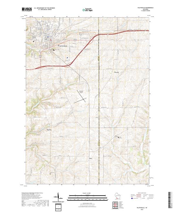
The University of Wisconsin-Platteville serves as a major focal point in the northwest corner of this map, anchoring a landscape where the urban street grid of Platteville transitions into the rolling agricultural lands of the Driftless Area. The terrain is deeply incised by a network of waterways including Rountree Br, Blockhouse Cr, and the Galena River, which flow past historic rural clusters like Bigpatch, Ipswich, and Elmo.
Find a feature on this map
100 named features on this map. Tap any name to fly to it.
Don’t see what you’re looking for? This feature index may not catch every label — zoom into the map to look around manually.
Map Details
Date Portrayed2022
Date Published2022
PublisherU.S. Geological Survey
Map TypeTopographic
Scale1:24000
Physical Dimensions24 x 29 inches
Editions of this 2022 Platteville Map
This is the sole edition of this map. No revisions or reprints were ever made.
Historical Maps of Benton Through Time
Featured Locations
Source Details
SourceU.S. Geological Survey
CopyrightPublic Domain