Old Maps of Lafayette County, Wisconsin
Explore 124 old maps of Lafayette County, spanning from 1902 to today. These high-resolution historic maps reveal how streets, neighborhoods, landmarks, and natural features evolved over time — perfect for genealogy, metal detecting, research, and local history exploration.
What you can do with these maps:
- See how Lafayette County changed over time: Compare historical maps to modern-day views to trace roads, homesites, rail lines & more.
- View detailed metadata: Each map includes creators, publishers, year, scale, and archive source.
- Overlay maps with satellite & LiDAR: Visualize the past alongside modern tools to explore terrain & human change.
- Trusted historical sources: Maps sourced from the USGS, Library of Congress, and other archives.
- Access maps your way: View online, download high-res files, or order prints for personal or research use.
Start exploring old maps of Lafayette County to uncover forgotten places, hidden landmarks, and the deep history beneath your feet.
Lafayette County, WI maps
(124)- 1902 Map of Mineral Point
 1902 Mineral Point1902 Print · USGSSouthwest Wisconsin and Northern Illinois are mapped here at the height of the regional mining era. Genealogists and historians can trace the rail lines of the Illinois Central to vanished junctions and local landmarks like Meekers Grove, Calamine, and Elk Grove.4 unique versions available
 - 1923 Map of Blanchardville
 1923 Blanchardville1923 Print · USGSThe Driftless Area of southwest Wisconsin comes alive in the early 1920s, showing a landscape defined by the Pecatonica River and early rail lines. Genealogists can locate dozens of rural landmarks, from the York Churches to schools like Lukken School and Arneson School.2 unique versions available
 - 1923 Map of South Wayne
 1923 South Wayne1923 Print · USGSSouthern Wisconsin and northern Illinois are shown in the early twenties as a landscape of interconnected river valleys and rail lines. Genealogists can trace dozens of country schoolhouses and churches, including Apple Grove Church, Reed School, and the community at South Wayne.3 unique versions available
 - 1952 Map of Shullsburg, 1954 Print
 1952 Shullsburg1954 Print · USGSShullsburg and the surrounding driftless area are shown in the early fifties during a period of transition for its lead and zinc mining industry. Researchers can trace historic family burial sites at St Matthews Cem and Monticello Cem or locate rural landmarks like Dunbarton Sch.2 unique versions available
 - 1952 Map of Platteville, 1954 Print
 1952 Platteville1954 Print · USGSIn the early fifties, the mining and academic life of Southwest Wisconsin converged at the junction of two major railroads. Genealogists and historians can locate rural landmarks like the Old Elk Grove Cem, the remote Woodchuck Sch, and numerous extraction sites such as Acme Mine.2 unique versions available
 - 1952 Map of Calamine, 1954 Print
 1952 Calamine1954 Print · USGSLafayette County in the early fifties shows a rural landscape defined by the winding Pecatonica River and the local rail line. Genealogists can locate numerous country schools and cemeteries like Hamestreet Sch, Truman, and Union Grove Cemetery.
 - 1952 Map of Rewey, 1954 Print
 1952 Rewey1954 Print · USGSRewey and the surrounding dairy country of Iowa, Grant, and Lafayette counties are shown here in the early fifties during a period of transition. Genealogists can locate several family-named burial sites like McReynolds Cem and rural schoolhouses including Hazel Dell Sch and Sunny Dale Sch.3 unique versions available
 - 1952 Map of Mineral Point, 1954 Print
 1952 Mineral Point1954 Print · USGSMineral Point and its surrounding lead-mining country are shown here in the early fifties, just as the rural school system remained intact. Genealogists can locate family sites near Willow Springs Church, St. Marys Cemetery, or small districts like Slateford and Seven Oaks School.3 unique versions available
 - 1952 Map of Cuba City, 1954 Print
 1952 Cuba City1954 Print · USGSThe Wisconsin-Illinois state line comes alive in the early fifties, showing a landscape of zinc and lead mining history near the Galena River. Genealogists can trace rural life through a network of local schools like Hell Sch and cemeteries such as Mt Pleasant Cem.3 unique versions available
 - 1952 Map of Belmont, 1954 Print
 1952 Belmont1954 Print · USGSLafayette County agricultural and mining districts are captured here in the early fifties during a period of active rural life. Genealogists can locate family landmarks like Strawberry Cem, the Roseville Ch, and local schools such as St Peters Sch.2 unique versions available
 - 1952 Map of New Diggings, 1954 Print
 1952 New Diggings1954 Print · USGSLead and zinc mining dominates the landscape of Lafayette County during the early fifties, where extraction sites are woven into a network of rural schools and churches. Genealogists and historians can trace family-named landmarks like Sullivan Sch, O'Brien Sch, and the Shawnee Cem.
 - 1952 Map of Mifflin, 1954 Print
 1952 Mifflin1954 Print · USGSIowa and Lafayette counties in the early fifties show a landscape where mining and pioneer history meet. Genealogists and researchers can trace rural school districts like Jericho Sch, find the historic First Capitol State Park, and locate family plots at Mifflin Cem.2 unique versions available
 - 1954 Map of Rockford
 1954 Rockford1954 Print · USGSThe Rock River valley and the Illinois-Wisconsin borderlands are captured here in the mid-1950s during a period of robust industrial and agricultural activity. Genealogists and historians can trace rail-era corridors like the Illinois Central RR and locate landmarks from Big Foot Prairie to Lake Geneva.
 - 1955 Map of Rockford
 1955 Rockford1955 Print · USGSThe Rock River valley and southern Wisconsin dairy country are shown here in the mid-fifties as the region's manufacturing centers grew. Genealogists and historians can trace the paths of the Chicago and North Western RR and Illinois Central RR through hubs like Rockford and Beloit.
 - 1958 Map of Rockford, 1974 Print
 1958 Rockford1974 Print · USGSNorthern Illinois and southern Wisconsin are shown here in the mid-twentieth century as rail-dependent industrial towns began to interface with growing lakefront communities. Genealogists can trace family roots through settlements like Saylesville and Tess Corners or locate historical landmarks like the Rockford Ordnance Depot.4 unique versions available
 - 1959 Map of Dubuque, 1982 Print
 1959 Dubuque1982 Print · USGSThe Tri-State region comes alive in the mid-twentieth century as a hub of river commerce and rail transit. Genealogists and historians can trace the paths of the Illinois Central Gulf through Dubuque or locate the Savanna Ordnance Depot and Lock and Dam No 11.
 - 1961 Map of Dubuque
 1961 Dubuque1961 Print · USGSThe Tri-State region's river-and-rail landscape is captured here during the early sixties, showing the convergence of Iowa, Illinois, and Wisconsin. Trace mid-century rail lines like the Chicago Great Western Ry and explore sites like the Savanna Ordnance Depot and Backbone State Park.
 - 1962 Map of Dubuque
 1962 Dubuque1962 Print · USGSThe Tri-State region's river-and-rail economy is captured here in the early sixties, centered on the Mississippi River bluffs. Genealogists and historians can locate Numerous lead and zinc mines, the New Melleray Abbey Monastery, and rural hubs like Saint Olaf.2 unique versions available
 - 1962 Map of Blanchardville, 1964 Print
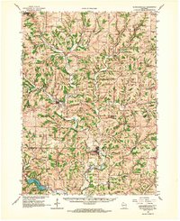 1962 Blanchardville1964 Print · USGSSouthern Wisconsin's rolling uplands and river valleys are captured here in the early sixties, showing the vital rail-and-river connection at Blanchardville. Researchers can trace rural life through dozens of local landmarks like the Moscow Center School, Yellowstone Church, and the newly created Yellowstone Lake.
 - 1962 Map of Wiota, 1964 Print
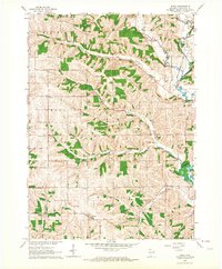 1962 Wiota1964 Print · USGSLafayette County in the early sixties remains a landscape of tightly-knit rural townships and family farms. Researchers can trace ancestral roots through numerous local landmarks like Andrews Cem, Apple Grove Ch, and schools such as Van Meter Sch.2 unique versions available
 - 1962 Map of Browntown, 1964 Print
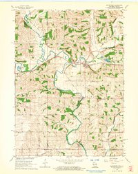 1962 Browntown1964 Print · USGSThe Pecatonica River valley at the Wisconsin-Illinois border is shown here in the early sixties, defined by its riverside rail towns. Researchers can trace local heritage through sites like Martintown, La Due Cem, and the Lattice Bridge.2 unique versions available
 - 1962 Map of Darlington, 1964 Print
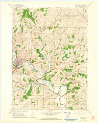 1962 Darlington1964 Print · USGSLafayette County was a hub of river commerce and rural education in the early sixties. Genealogists can locate family sites near Holy Rosary Cem or trace the old rail lines of the Chicago Milwaukee St Paul and Pacific through Darlington.
 - 1962 Map of South Wayne, 1964 Print
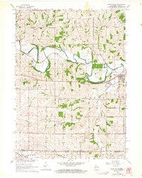 1962 South Wayne1964 Print · USGSLafayette County dairy and river country is captured here in the early sixties, centered on the junction of the Pecatonica River and the railroad. Genealogists and local historians can trace rural schoolhouse locations like Mud Hollow Sch and family burial sites such as Hoffman Cem.
 - 1962 Map of Argyle, 1964 Print
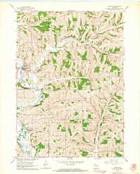 1962 Argyle1964 Print · USGSSouthwestern Wisconsin farmland and river valleys are captured here during the early sixties, centered on the winding East Branch Pecatonica River. Genealogists and researchers can trace the Illinois Central Railroad through Woodford and locate rural landmarks like St Francis Ch and Jockey Hollow.
 - 1962 Map of Waldwick, 1964 Print
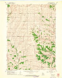 1962 Waldwick1964 Print · USGSThe rural borders of Iowa and Lafayette Counties come alive in this early 1960s survey of the Wisconsin driftless landscape. Researchers can trace the heritage of Waldwick and Fayette, locating historic sites like Jackson Cem and the Broad View Sch.2 unique versions available
Showing maps 1-25 of 124
Top cities of Lafayette County
- Darlington historical maps
- Shullsburg historical maps
- Benton historical maps
- Belmont historical maps
- Wiota historical maps
- Argyle historical maps
See more
Frequently asked questions
- What are the different types of historical maps available for Lafayette County?
- What is the oldest map of Lafayette County?
- Where can I purchase historical maps of Lafayette County for my home or office?
- Where can I download high-res historical maps of Lafayette County?
- Are there historical topographic maps available for Lafayette County?
- Is there historical aerial imagery available for Lafayette County?
- Where are historical maps of Lafayette County sourced from?