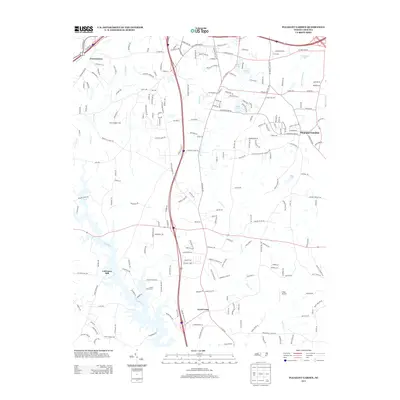
2013 Map of Pleasant Garden
USGS Topo · Published 2013About this map
Deep River winds through the southern landscape of this Guilford County region, where rural roads and small-scale developments define the transition between established settlements. In the east, Pleasant Garden serves as a primary hub, while the communities of Groometown and Level Cross anchor the northern and southern reaches. The area is characterized by several named water bodies and small impoundments such as Benbow Lake, Hunt Lake, and Yowland Lake, which point to a geography shaped by agricultural ponding and residential recreation.
Find a feature on this map
213 named features on this map. Tap any name to fly to it.
Don’t see what you’re looking for? This feature index may not catch every label — zoom into the map to look around manually.
Map Details
Editions of this 2013 Pleasant Garden Map
This is the sole edition of this map. No revisions or reprints were ever made.
Other maps of this area

1950 · High Point East
USGS Topo · 1:24,000

1951 · High Point East
USGS Topo · 1:24,000

1951 · Guilford
USGS Topo · 1:24,000

1951 · Greensboro
USGS Topo · 1:24,000

1952 · Mc Leansville
USGS Topo · 1:24,000

1953 · Raleigh
USGS Topo · 1:250,000

1953 · Greensboro
USGS Topo · 1:250,000

1954 · Greensboro
USGS Topo · 1:250,000

1954 · Raleigh
USGS Topo · 1:250,000

1962 · Greensboro
USGS Topo · 1:250,000