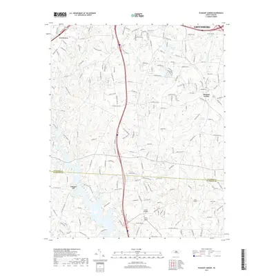
2019 Map of Pleasant Garden
USGS Topo · Published 2019About this map
The transition from the southern outskirts of Greensboro into the rural stretches of Guilford and Randolph counties defines this 2019 survey. The area around Pleasant Garden and Groometown reflects modern residential expansion alongside older community nodes like Level Cross and Coltranes Mill. Numerous small lakes, including Benbow Lake, Yowland Lake, and Wood Lake, dot the landscape, primarily fed by the drainages of Hickory Creek and Polecat Creek. The map documents a complex web of local roads such as S Holden Road and Rehobeth Church Road that connect these growing suburban fringes with established aviation landmarks like Fields Airport. This detailed topographic record captures the specific character of the Piedmont region as traditional agricultural lands and mill sites meet contemporary infrastructure.
Find a feature on this map
169 named features on this map. Tap any name to fly to it.
Don’t see what you’re looking for? This feature index may not catch every label — zoom into the map to look around manually.
Map Details
Editions of this 2019 Pleasant Garden Map
This is the sole edition of this map. No revisions or reprints were ever made.
Other maps of this area

1950 · High Point East
USGS Topo · 1:24,000

1951 · High Point East
USGS Topo · 1:24,000

1951 · Guilford
USGS Topo · 1:24,000

1951 · Greensboro
USGS Topo · 1:24,000

1952 · Mc Leansville
USGS Topo · 1:24,000

1953 · Raleigh
USGS Topo · 1:250,000

1953 · Greensboro
USGS Topo · 1:250,000

1954 · Greensboro
USGS Topo · 1:250,000

1954 · Raleigh
USGS Topo · 1:250,000

1962 · Greensboro
USGS Topo · 1:250,000