2023 Map of Pleasant Hill
USGS Topo · Published 2023About this map
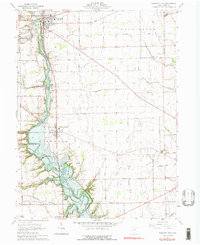
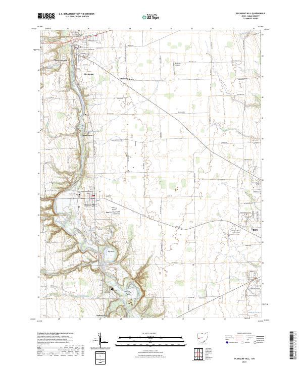
The Stillwater River carves a winding path through this portion of Miami County, defining a landscape of agricultural plateaus and deeply etched drainage patterns. The river's dramatic oxbows are evident at Big Bend and Horseshoe Bend, where the terrain drops toward the water's edge. This area exhibits a dense network of early settlements and small unincorporated communities, including Covington and its neighbor West Covington, as well as Mulberry Grove and Sugar Grove. Local aviation history is represented by Bowman Airport and Bashore Airport, while the village of Ludlow Falls sits at the southern edge of the sheet. For genealogists, the map identifies several key burial sites such as Pleasant Hill Cem and the Old Union Cem, providing precise locations for family history research within the traditional township and range survey system.
Find a feature on this map
71 named features on this map. Tap any name to fly to it.
Don’t see what you’re looking for? This feature index may not catch every label — zoom into the map to look around manually.
Map Details
Editions of this 2023 Pleasant Hill Map
This is the sole edition of this map. No revisions or reprints were ever made.