2022 Map of Pleasanton
USGS Topo · Published 2022About this map
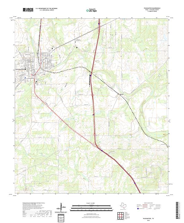
Atascosa River drainage patterns define this South Texas landscape, where the city of Pleasanton serves as a primary hub of residential and commercial growth. This modern topographic record reveals a dense concentration of local heritage sites, particularly evident in the cluster of burial grounds such as Saint Andrews Cem, Sotelo Cem, and San Ysidro Cem. These sites, along with Jacob's Chapel Cem, offer critical data points for genealogists tracking family lineages in Atascosa County.
Find a feature on this map
91 named features on this map. Tap any name to fly to it.
Don’t see what you’re looking for? This feature index may not catch every label — zoom into the map to look around manually.
Map Details
Editions of this 2022 Pleasanton Map
This is the sole edition of this map. No revisions or reprints were ever made.
Historical Maps of Pleasanton Through Time
4 maps found