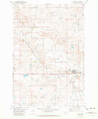
1981 Map of Plevna
USGS Topo · Published 1981About this map
Plevna serves as the central hub of this eastern Montana landscape, situated at the intersection of the Chicago Milwaukee St Paul and Pacific railroad and the waters of Sandstone Creek. The town's civic life is centered around its High Sch, while several distinct burial grounds, including the Community Union Cem, Peace Lutheran Cem, and St Anthony Cem, reflect the heritage of the local community. The terrain is defined by its drainage systems, with the South Fork and Hay Creek carving through the plains, while the presence of numerous Well sites and a Gravel Pit indicates the area's reliance on groundwater and local materials. The alignment of the railroad through the Sandstone Creek valley highlights the critical link between topography and transport in this ranching and farming region.
Find a feature on this map
15 named features on this map. Tap any name to fly to it.
Don’t see what you’re looking for? This feature index may not catch every label — zoom into the map to look around manually.
Map Details
Editions of this 1981 Plevna Map
This is the sole edition of this map. No revisions or reprints were ever made.
Other maps of this area

1953 · Miles City
USGS Topo · 1:250,000

1957 · Miles City
USGS Topo · 1:250,000

1958 · Miles City
USGS Topo · 1:250,000

1981 · Baker
USGS Topo · 1:100,000

1981 · South Sandstone Reservoir
USGS Topo · 1:24,000

1981 · Lawrence Creek East
USGS Topo · 1:24,000

1981 · Lawrence Creek West
USGS Topo · 1:24,000

1981 · Little Pine Creek
USGS Topo · 1:24,000

1981 · Baker NW
USGS Topo · 1:24,000

1981 · Ayer Spring
USGS Topo · 1:24,000