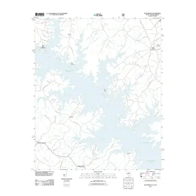
2011 Map of Plum Branch
USGS Topo · Published 2011About this map
The waters of the J. Strom Thurmond Reservoir dominate this landscape on the South Carolina and Georgia border, where the flooded valleys of Hawe Creek and Benningsfield Creek create a complex, jagged shoreline. This 2011 survey captures the area's transition into a recreation-focused region, anchored by Clark Hill Marina and the Hawe Creek Camping Area. Despite the massive reservoir, the traditional rural character remains visible in the surrounding hills, where small settlements like Plum Branch and Maxim are connected by a network of state roads including State Hwy S-33-70.
Find a feature on this map
54 named features on this map. Tap any name to fly to it.
Don’t see what you’re looking for? This feature index may not catch every label — zoom into the map to look around manually.
Map Details
Editions of this 2011 Plum Branch Map
This is the sole edition of this map. No revisions or reprints were ever made.
Other maps of this area

1892 · Mc Cormick
USGS Topo · 1:125,000

1912 · Mc Cormick
USGS Topo · 1:125,000

1920 · Clarks Hill
USGS Topo · 1:48,000

1921 · Clarks Hill
USGS Topo · 1:62,500

1921 · Appling
USGS Topo · 1:62,500

1941 · Clarks Hill
USGS Topo · 1:62,500

1942 · Clarks Hill
USGS Topo · 1:62,500

1943 · Appling
USGS Topo · 1:62,500

1953 · Athens
USGS Topo · 1:250,000

1958 · Athens
USGS Topo · 1:250,000