2023 Map of Plumwood
USGS Topo · Published 2023About this map
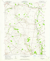
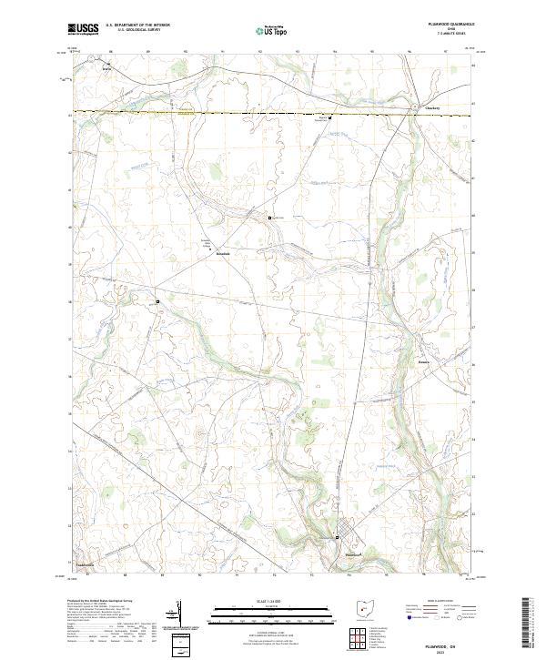
Rosedale Bible College stands as a focal point in this agricultural landscape on the border of Union and Madison counties. The terrain is defined by a sophisticated network of drainage infrastructure, with named channels like Boerger Ditch and Booth Ditch feeding into larger waterways such as Little Darby Creek and Spring Fork. This intricate management of the watershed supports a scattered pattern of small settlements including Plumwood, Rosedale, and Tradersville. For those exploring local family histories, the map preserves the locations of several burial grounds, from the Bigelow Pioneer Cem in the north to Plumwood Cem in the south, alongside family-named roads like Josiah Morris Rd and David Brown Rd.
Find a feature on this map
51 named features on this map. Tap any name to fly to it.
Don’t see what you’re looking for? This feature index may not catch every label — zoom into the map to look around manually.
Map Details
Editions of this 2023 Plumwood Map
This is the sole edition of this map. No revisions or reprints were ever made.