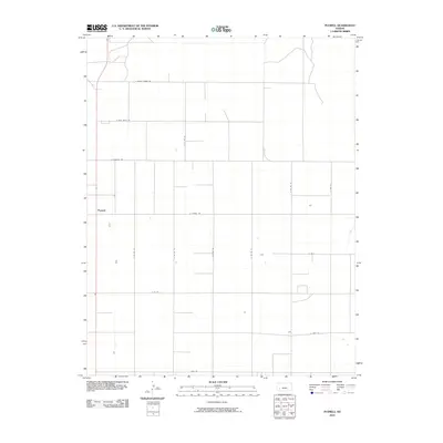
2010 Map of Plymell
USGS Topo · Published 2010About this map
Plymell serves as the central reference point for this portion of the High Plains in southwest Kansas. The landscape is defined by a rigid, rectilinear grid of county roads that reflect the systematic agricultural development of the region. Many of these thoroughfares bear the names of local families, such as E Annie Scheer Rd, E Pete Smith Rd, and S Lightner Rd, offering a direct link to the area's genealogical and land-ownership history. The prevalence of these named routes, including E Plymell Rd and Lear Rd, illustrates how the rural infrastructure was established to serve a dispersed farming community. This 2010 survey by the U.S. Geological Survey documents the enduring spatial organization of the Kansas prairie, where the intersection of roads like E Parallel Rd and S Co Rd 14 continues to define the geography of the plains.
Find a feature on this map
16 named features on this map. Tap any name to fly to it.
Don’t see what you’re looking for? This feature index may not catch every label — zoom into the map to look around manually.
Map Details
Editions of this 2010 Plymell Map
This is the sole edition of this map. No revisions or reprints were ever made.
Other maps of this area

1896 · Garden
USGS Topo · 1:125,000

1955 · Dodge City
USGS Topo · 1:250,000

1958 · Dodge City
USGS Topo · 1:250,000

1959 · Dodge City
USGS Topo · 1:250,000

1959 · Garden City 3 NW
USGS Topo · 1:24,000

1959 · Garden City 3 NE
USGS Topo · 1:24,000

1960 · Garden City East
USGS Topo · 1:24,000

1960 · Garden City SW
USGS Topo · 1:24,000
1960 · Garden City West
USGS Topo · 1:24,000

1960 · Plymell
USGS Topo · 1:24,000