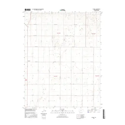
2016 Map of Plymell
USGS Topo · Published 2016About this map
Plymell serves as the central settlement hub of this southwestern Kansas landscape, positioned along the corridor of S Old US Hwy 83. The map reveals a strictly organized agricultural grid, with section lines and rural thoroughfares such as E Annie Scheer Rd and E Pete Smith Rd defining the territory. This pattern illustrates the systematic development of Finney County farming, where irrigation and access to regional transit routes have long dictated land use. Large-scale agricultural operations are supported by a network of secondary roads including S Lightner Rd and E Tv Rd, facilitating the movement of machinery and crops across the plains. This 2016 survey documents the enduring layout of the Public Land Survey System, with township boundaries like t25s r32w and t26s r32w framing the local geography.
Find a feature on this map
22 named features on this map. Tap any name to fly to it.
Don’t see what you’re looking for? This feature index may not catch every label — zoom into the map to look around manually.
Map Details
Editions of this 2016 Plymell Map
This is the sole edition of this map. No revisions or reprints were ever made.
Other maps of this area

1896 · Garden
USGS Topo · 1:125,000

1955 · Dodge City
USGS Topo · 1:250,000

1958 · Dodge City
USGS Topo · 1:250,000

1959 · Dodge City
USGS Topo · 1:250,000

1959 · Garden City 3 NW
USGS Topo · 1:24,000

1959 · Garden City 3 NE
USGS Topo · 1:24,000

1960 · Garden City East
USGS Topo · 1:24,000

1960 · Garden City SW
USGS Topo · 1:24,000
1960 · Garden City West
USGS Topo · 1:24,000

1960 · Plymell
USGS Topo · 1:24,000