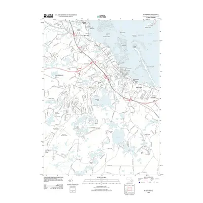
2012 Map of Plymouth
USGS Topo · Published 2012About this map
Plymouth Rock remains the focal point of this coastal landscape, situated near the Plymouth Town Wharf and the Massachusetts State Pier. The maritime heritage of the area is further evidenced by the numerous landings and points, such as Delano's Wharf and Stephens Field Beach, which line the harbor protected by the long reach of Plymouth Beach. Inland, the terrain is defined by a dense concentration of glacial ponds, including Billington Sea and Great South Pond, which historically supported early industrial efforts like the Russell Millpond and the reconstructed Jenney Grist Mill.
Find a feature on this map
332 named features on this map. Tap any name to fly to it.
Don’t see what you’re looking for? This feature index may not catch every label — zoom into the map to look around manually.
Map Details
Editions of this 2012 Plymouth Map
This is the sole edition of this map. No revisions or reprints were ever made.
Other maps of this area

1885 · Abington
USGS Topo · 1:62,500

1885 · Duxbury
USGS Topo · 1:62,500

1885 · Middleboro
USGS Topo · 1:62,500

1886 · Plymouth
USGS Topo · 1:62,500

1888 · Duxbury
USGS Topo · 1:62,500

1888 · Middleboro
USGS Topo · 1:62,500

1888 · Abington
USGS Topo · 1:62,500

1889 · Plymouth
USGS Topo · 1:62,500

1893 · Abington
USGS Topo · 1:62,500

1893 · Duxbury
USGS Topo · 1:62,500