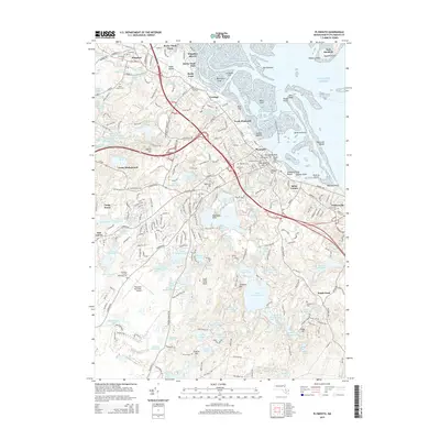
2015 Map of Plymouth
USGS Topo · Published 2015About this map
Plymouth Rock and the historic harbor front anchor this 2015 study of the Massachusetts coastline, illustrating the dense residential and memorial landscape of one of America's oldest settlements. The map details a high concentration of burial grounds, including Burial Hill Cem and Evergreen Cem, which provide significant value for genealogical research. From the industrial heritage at Cordage to the suburban expansion near Jabez Corner, the geography shows a complex mix of historic preservation and modern infrastructure. Beyond the town center, the terrain is defined by a glacial landscape of kettle ponds such as Narragansett Pond and Fresh Meadow Pond, while Plymouth Municipal Airport and Fort Standish on the outer harbor mark the area's logistical and coastal defense significance.
Find a feature on this map
171 named features on this map. Tap any name to fly to it.
Don’t see what you’re looking for? This feature index may not catch every label — zoom into the map to look around manually.
Map Details
Editions of this 2015 Plymouth Map
This is the sole edition of this map. No revisions or reprints were ever made.
Other maps of this area

1885 · Abington
USGS Topo · 1:62,500

1885 · Duxbury
USGS Topo · 1:62,500

1885 · Middleboro
USGS Topo · 1:62,500

1886 · Plymouth
USGS Topo · 1:62,500

1888 · Duxbury
USGS Topo · 1:62,500

1888 · Middleboro
USGS Topo · 1:62,500

1888 · Abington
USGS Topo · 1:62,500

1889 · Plymouth
USGS Topo · 1:62,500

1893 · Abington
USGS Topo · 1:62,500

1893 · Duxbury
USGS Topo · 1:62,500