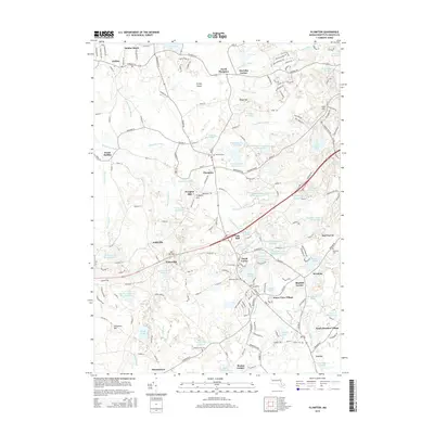
2015 Map of Plympton
USGS Topo · Published 2015About this map
Plympton serves as a central hub in this survey of Plymouth County, where the landscape is defined by an intricate network of bogs and reservoirs. The drainage patterns of the Winnetuxet River and Annasnappet Brook are heavily modified by regional industry, as seen in the Plympton Bog N Reservoir and the Bay State Company Bog Reservoir. These water management systems are characteristic of the local cranberry production economy, which shaped the development of surrounding hamlets like Eddyville, Waterville, and North Carver.
Find a feature on this map
188 named features on this map. Tap any name to fly to it.
Don’t see what you’re looking for? This feature index may not catch every label — zoom into the map to look around manually.
Map Details
Editions of this 2015 Plympton Map
This is the sole edition of this map. No revisions or reprints were ever made.
Other maps of this area

1885 · Abington
USGS Topo · 1:62,500

1885 · Duxbury
USGS Topo · 1:62,500

1885 · Middleboro
USGS Topo · 1:62,500

1886 · Plymouth
USGS Topo · 1:62,500

1888 · Duxbury
USGS Topo · 1:62,500

1888 · Middleboro
USGS Topo · 1:62,500

1888 · Abington
USGS Topo · 1:62,500

1889 · Plymouth
USGS Topo · 1:62,500

1893 · Abington
USGS Topo · 1:62,500

1893 · Duxbury
USGS Topo · 1:62,500