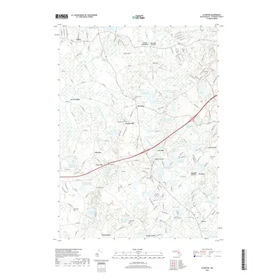
2018 Map of Plympton
USGS Topo · Published 2018About this map
The Winnetuxet River and Annasnappet Brook define this landscape of cranberry cultivation and reservoir systems in Plymouth County. By 2018, the area around Plympton and North Carver shows an intricate network of specialized water management, featuring names like Winebrook Bogs, Plympton Bog North Reservoir, and A Godfrey Bog Reservoir. These features speak to the region's enduring agricultural legacy, specifically the industrial-scale cranberry production that has shaped the drainage of the Jones River basin for generations.
Find a feature on this map
191 named features on this map. Tap any name to fly to it.
Don’t see what you’re looking for? This feature index may not catch every label — zoom into the map to look around manually.
Map Details
Editions of this 2018 Plympton Map
This is the sole edition of this map. No revisions or reprints were ever made.
Other maps of this area

1885 · Abington
USGS Topo · 1:62,500

1885 · Duxbury
USGS Topo · 1:62,500

1885 · Middleboro
USGS Topo · 1:62,500

1886 · Plymouth
USGS Topo · 1:62,500

1888 · Duxbury
USGS Topo · 1:62,500

1888 · Middleboro
USGS Topo · 1:62,500

1888 · Abington
USGS Topo · 1:62,500

1889 · Plymouth
USGS Topo · 1:62,500

1893 · Abington
USGS Topo · 1:62,500

1893 · Duxbury
USGS Topo · 1:62,500