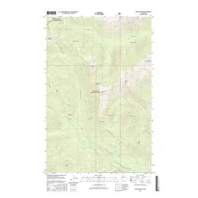
2017 Map of Poe Mountain
USGS Topo · Published 2017About this map
Poe Mountain and the high ridges of the North Cascades define this 2017 study of the Wenatchee National Forest and Mount Baker National Forest. The landscape is a network of sharp divides and deep drainages, where the Little Wenatchee River is fed by numerous tributaries including Cady Creek, Fall Cr, and Cockeye Cr. Historical movement through this high country is marked by named crossings such as Indian Pass and Irving Pass, which once served as vital links between these steep valleys.
Find a feature on this map
45 named features on this map. Tap any name to fly to it.
Don’t see what you’re looking for? This feature index may not catch every label — zoom into the map to look around manually.
Map Details
Editions of this 2017 Poe Mountain Map
This is the sole edition of this map. No revisions or reprints were ever made.
Other maps of this area

1899 · Glacier Peak
USGS Topo · 1:125,000

1901 · Glacier Peak
USGS Topo · 1:125,000

1901 · Chiwaukum
USGS Topo · 1:125,000

1902 · Skykomish
USGS Topo · 1:125,000

1902 · Stehekin
USGS Topo · 1:125,000

1904 · Stehekin
USGS Topo · 1:125,000

1904 · Chiwaukum
USGS Topo · 1:125,000

1905 · Skykomish
USGS Topo · 1:125,000

1944 · Holden
USGS Topo · 1:62,500

1949 · Holden
USGS Topo · 1:62,500