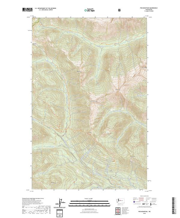
2023 Map of Poe Mountain
USGS Topo · Published 2023About this map
The Glacier Peak Wilderness and Henry M Jackson Wilderness dominate this high-elevation landscape, where the Washington and Chelan county line follows the crest of the Cascade Range. Central to this terrain is the Little Wenatchee River drainage, which provides a natural corridor for the Little Wenatchee River Trl. The map details a complex network of high-country paths, including the Cady Ridge Trl and Poe Mountain Trl, which connect prominent summits like Longfellow Mtn, Bryant Peak, and Whittier Peak. Small alpine water bodies, such as Top Lake and Lake Creek, are tucked into the drainages of Wenatchee Ridge. At the northern edge, the open basin of Meander Meadow provides a distinct break in the steep, creek-cut slopes that define this protected forest region.
Find a feature on this map
43 named features on this map. Tap any name to fly to it.
Don’t see what you’re looking for? This feature index may not catch every label — zoom into the map to look around manually.
Map Details
Editions of this 2023 Poe Mountain Map
This is the sole edition of this map. No revisions or reprints were ever made.
Other maps of this area

1899 · Glacier Peak
USGS Topo · 1:125,000

1901 · Glacier Peak
USGS Topo · 1:125,000

1901 · Chiwaukum
USGS Topo · 1:125,000

1902 · Skykomish
USGS Topo · 1:125,000

1902 · Stehekin
USGS Topo · 1:125,000

1904 · Stehekin
USGS Topo · 1:125,000

1904 · Chiwaukum
USGS Topo · 1:125,000

1905 · Skykomish
USGS Topo · 1:125,000

1944 · Holden
USGS Topo · 1:62,500

1949 · Holden
USGS Topo · 1:62,500