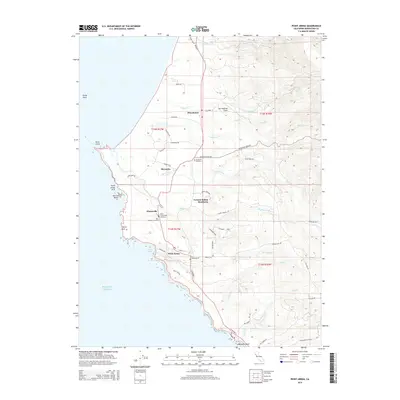
2015 Map of Point Arena
USGS Topo · Published 2015About this map
Point Arena and the Mendocino coast are defined by the collision of maritime and geological forces, most notably the visible line of the San Andreas Fault cutting through the terrain north of the Garcia River. The 2015 landscape shows a coastal economy tied to its natural landmarks, from the headlands at Point Arena Arch and Sea Lion Rocks to the protected waters of Arena Cove. Inland, the settlement patterns of Manchester and Stronetta are woven between creek drainages like Brush Cr and Alder Cr, while the Iverson Indian Rancheria sits positioned between the river and the sea.
Find a feature on this map
61 named features on this map. Tap any name to fly to it.
Don’t see what you’re looking for? This feature index may not catch every label — zoom into the map to look around manually.
Map Details
Editions of this 2015 Point Arena Map
This is the sole edition of this map. No revisions or reprints were ever made.
Other maps of this area

1943 · Point Arena
USGS Topo · 1:62,500

1943 · Albion
USGS Topo · 1:62,500

1943 · Navarro
USGS Topo · 1:62,500

1944 · Saddle Point
USGS Topo · 1:62,500

1947 · Santa Rosa
USGS Topo · 1:250,000

1949 · Santa Rosa
USGS Topo · 1:250,000

1957 · Ukiah
USGS Topo · 1:250,000

1958 · Santa Rosa
USGS Topo · 1:250,000

1960 · Ukiah
USGS Topo · 1:250,000

1960 · Saunders Reef
USGS Topo · 1:24,000