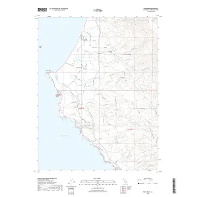
2018 Map of Point Arena
USGS Topo · Published 2018About this map
The coastal bluff of Point Arena defines this stretch of Mendocino County, where the terrestrial landscape meets the Pacific. The San Andreas Fault cuts through the inland terrain, influencing the drainage of the Garcia River and several coastal creeks. Settlements such as Manchester and Flumeville are clustered near the shore, connected by a network of rural roads like Mountain View Rd and Windy Hollow Rd. Local history is anchored by several burial sites, including the Point Arena IOOF Cem and the Saint Aloysius Cem.
Find a feature on this map
75 named features on this map. Tap any name to fly to it.
Don’t see what you’re looking for? This feature index may not catch every label — zoom into the map to look around manually.
Map Details
Editions of this 2018 Point Arena Map
This is the sole edition of this map. No revisions or reprints were ever made.
Other maps of this area

1943 · Point Arena
USGS Topo · 1:62,500

1943 · Albion
USGS Topo · 1:62,500

1943 · Navarro
USGS Topo · 1:62,500

1944 · Saddle Point
USGS Topo · 1:62,500

1947 · Santa Rosa
USGS Topo · 1:250,000

1949 · Santa Rosa
USGS Topo · 1:250,000

1957 · Ukiah
USGS Topo · 1:250,000

1958 · Santa Rosa
USGS Topo · 1:250,000

1960 · Ukiah
USGS Topo · 1:250,000

1960 · Saunders Reef
USGS Topo · 1:24,000