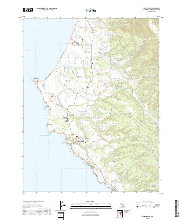
2021 Map of Point Arena
USGS Topo · Published 2021About this map
Point Arena serves as the focal point of this coastal survey, where the town sits perched above Arena Cove on the Mendocino shoreline. The landscape is defined by the sharp transition from the Pacific waters to the rising heights of Adams Ridge. Local history is anchored by several distinct burial grounds, including the Point Arena IOOF Cem, Saint Aloysius Cem, and Evergreen Cem, each providing genealogical touchstones for the area's early families. The coastal margin is marked by dramatic geological features such as the Point Arena Arch and Sea Lion Rocks, while the Garcia River and Lagoon Creek drain the interior uplands. Smaller settlements like Manchester and Flumeville are connected by a network of rural routes including Mountain View Rd and Kinney Rd, reflecting the region's enduring agricultural and maritime character.
Find a feature on this map
115 named features on this map. Tap any name to fly to it.
Don’t see what you’re looking for? This feature index may not catch every label — zoom into the map to look around manually.
Map Details
Editions of this 2021 Point Arena Map
This is the sole edition of this map. No revisions or reprints were ever made.
Other maps of this area

1943 · Point Arena
USGS Topo · 1:62,500

1943 · Albion
USGS Topo · 1:62,500

1943 · Navarro
USGS Topo · 1:62,500

1944 · Saddle Point
USGS Topo · 1:62,500

1947 · Santa Rosa
USGS Topo · 1:250,000

1949 · Santa Rosa
USGS Topo · 1:250,000

1957 · Ukiah
USGS Topo · 1:250,000

1958 · Santa Rosa
USGS Topo · 1:250,000

1960 · Ukiah
USGS Topo · 1:250,000

1960 · Saunders Reef
USGS Topo · 1:24,000