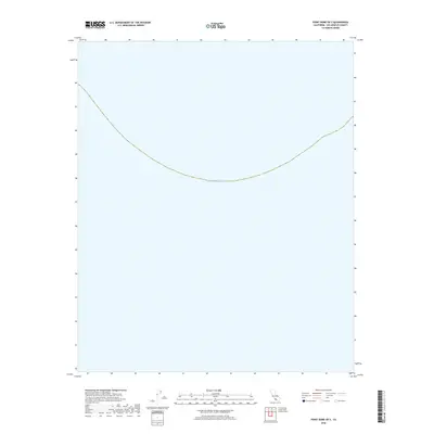
2018 Map of Point Dume OE S
USGS Topo · Published 2018About this map
The Pacific Ocean occupies the vast majority of this offshore quadrangle just south of the Los Angeles County coastline. This 2018 survey serves as a marine reference for the waters south of Point Dume, capturing the bathymetric boundary where the sea depth drops beyond the coastal shelf. While it contains no terrestrial settlements or landmarks, it accurately records the shoreline alignment and the navigational expanse of the Pacific Ocean as it appeared in the late 2010s.
Find a feature on this map
1 named feature on this map. Tap any name to fly to it.
Don’t see what you’re looking for? This feature index may not catch every label — zoom into the map to look around manually.
Map Details
Editions of this 2018 Point Dume OE S Map
This is the sole edition of this map. No revisions or reprints were ever made.
Other maps of this area

1900 · Triunfo Pass
USGS Topo · 1:62,500

1903 · Calabasas
USGS Topo · 1:62,500

1903 · Camulos
USGS Topo · 1:125,000

1921 · Triunfo Pass
USGS Topo · 1:62,500

1929 · Dume Point
USGS Topo · 1:24,000

1929 · Solstice Canyon
USGS Topo · 1:24,000

1932 · Dume Point
USGS Topo · 1:24,000
1932 · Solstice Canyon
USGS Topo · 1:24,000
1943 · Triunfo Pass
USGS Topo · 1:62,500
1944 · Calabasas
USGS Topo · 1:62,500