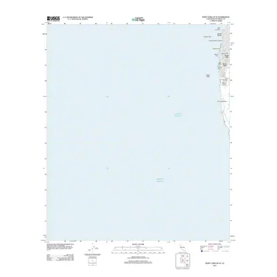
2012 Map of Point Loma OE W
USGS Topo · Published 2012About this map
Sunset Cliffs and the rugged coastline of San Diego define this coastal survey, where the Pacific surf meets a landscape of prominent landmarks and educational institutions. The map highlights the western edge of the Point Loma peninsula, featuring the campuses of Point Loma Nazarene University and California Western University overlooking the water. This maritime environment is punctuated by geological features such as Alligator Rock, Osprey Point, and New Hope Rock, which suggest the navigational complexity of these waters. Residential and recreational development is concentrated along the shore, with Ocean Beach City Beach and the long Ocean Beach Fishing Pier serving as focal points for the community. Neighborhoods like Riviera Villas and Azure Vista sit atop the bluffs, illustrating the high-density coastal land use common in southern California during the early 21st century.
Find a feature on this map
16 named features on this map. Tap any name to fly to it.
Don’t see what you’re looking for? This feature index may not catch every label — zoom into the map to look around manually.
Map Details
Editions of this 2012 Point Loma OE W Map
This is the sole edition of this map. No revisions or reprints were ever made.
Other maps of this area

1903 · La Jolla
USGS Topo · 1:62,500

1904 · San Diego
USGS Topo · 1:62,500

1904 · Southern California Sheet No. 2
USGS Topo · 1:250,000

1930 · La Jolla
USGS Topo · 1:62,500

1930 · San Diego
USGS Topo · 1:62,500

1942 · Point Loma
USGS Topo · 1:31,680

1943 · La Jolla
USGS Topo · 1:31,680

1950 · San Diego
USGS Topo · 1:250,000
1953 · La Jolla
USGS Topo · 1:24,000
1953 · Point Loma
USGS Topo · 1:24,000