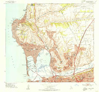
1953 Map of La Jolla
USGS Topo · Published 1955About this map
The coast of La Jolla and Pacific Beach reveals a mid-century landscape of rapid postwar expansion and institutional growth. The Scripps Institute of Oceanography sits prominently on the northern shore, while the inland areas show the emergence of neighborhoods like Clairemont and Linda Vista. This era was defined by a heavy military and aviation presence, with the Camp Mathews Naval Res and Miramar Naval Air Station flanking the developing residential grid. Transportation through the canyons was anchored by the Atchison Topeka and Santa Fe railroad, which passed through Rose Canyon near sidings at Elvira and Moreno. Cultural and educational landmarks are dense, ranging from the Junipero Serra Museum in Old Town to the Brown Military Academy and The Bishops School, reflecting the diverse social fabric of early 1950s San Diego.
Find a feature on this map
101 named features on this map. Tap any name to fly to it.
Don’t see what you’re looking for? This feature index may not catch every label — zoom into the map to look around manually.
Map Details
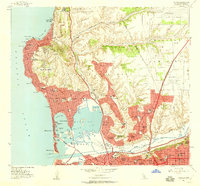
Editions of this 1953 La Jolla Map
2 editions found
Other maps of this area

1903 · La Jolla
USGS Topo · 1:62,500

1904 · San Diego
USGS Topo · 1:62,500

1904 · Southern California Sheet No. 2
USGS Topo · 1:250,000

1930 · La Jolla
USGS Topo · 1:62,500

1930 · San Diego
USGS Topo · 1:62,500

1942 · Poway Valley
USGS Topo · 1:31,680
1942 · La Mesa
USGS Topo · 1:31,680

1942 · Point Loma
USGS Topo · 1:31,680
1943 · Del Mar
USGS Topo · 1:31,680

1943 · La Jolla
USGS Topo · 1:31,680