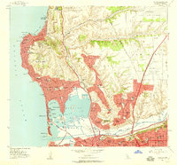
1953 Map of La Jolla
USGS Topo · Published 1959About this map
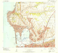
Soledad Mtn towers over the coastal residential growth of the early 1950s, defining the landscape between La Jolla and the developing Pacific Beach. The map captures a moment of significant institutional and military presence in San Diego, showing the Scripps Institute of Oceanography along the northern coast and the expansive Camp Mathews Naval Res inland. This survey details the complex shoreline geography from Point La Jolla down to the burgeoning Mission Bay Park, which at this time includes numerous named points and coves like Santa Clara Point and Tierra del Fuego. The industrial and transportation corridor is anchored by the Atchison Topeka and Santa Fe railroad line running through Rose Canyon, while the residential sprawl of Clairemont and Linda Vista begins to fill the mesas east of the coast.
Find a feature on this map
118 named features on this map. Tap any name to fly to it.
Don’t see what you’re looking for? This feature index may not catch every label — zoom into the map to look around manually.
Map Details
Editions of this 1953 La Jolla Map
2 editions found
Other maps of this area

1903 · La Jolla
USGS Topo · 1:62,500

1904 · San Diego
USGS Topo · 1:62,500

1904 · Southern California Sheet No. 2
USGS Topo · 1:250,000

1930 · La Jolla
USGS Topo · 1:62,500

1930 · San Diego
USGS Topo · 1:62,500

1942 · Poway Valley
USGS Topo · 1:31,680
1942 · La Mesa
USGS Topo · 1:31,680

1942 · Point Loma
USGS Topo · 1:31,680
1943 · Del Mar
USGS Topo · 1:31,680

1943 · La Jolla
USGS Topo · 1:31,680