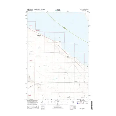
2014 Map of Point Nipigon
USGS Topo · Published 2014About this map
The Straits of Mackinac and the South Channel of Lake Huron dominate the northern landscape of this coastal Cheboygan County survey. The shoreline is marked by the seasonal and year-round communities of Point Nipigon, Grand View, and Pries Landing, all linked by the corridor of Us-23. Inland, the geography transitions into a network of rural roads and watercourses, including the Little Black River and its W Br Little Black River tributary.
Find a feature on this map
50 named features on this map. Tap any name to fly to it.
Don’t see what you’re looking for? This feature index may not catch every label — zoom into the map to look around manually.
Map Details
Editions of this 2014 Point Nipigon Map
This is the sole edition of this map. No revisions or reprints were ever made.
Other maps of this area

1955 · Cheboygan
USGS Topo · 1:250,000

1957 · Cheboygan
USGS Topo · 1:62,500

1957 · Mullett Lake
USGS Topo · 1:62,500

1958 · Cheboygan
USGS Topo · 1:250,000

1964 · Round Island
USGS Topo · 1:24,000
1964 · St. Ignace
USGS Topo · 1:24,000

1964 · McRae Bay
USGS Topo · 1:24,000

1982 · Cheboygan
USGS Topo · 1:25,000

1982 · Point Nipigon
USGS Topo · 1:25,000

1982 · Aloha
USGS Topo · 1:25,000