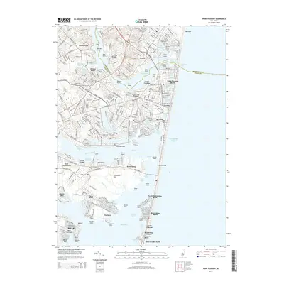
2014 Map of Point Pleasant
USGS Topo · Published 2014About this map
The Glimmerglass Bridge and the Manasquan River dominate the northern landscape of this coastal survey, where the border between Monmouth Co and Ocean Co cuts through the waterway toward the Manasquan Inlet. This document details the intricate coastal geography of New Jersey's shore during the early 21st century, showing the developed waterfronts of Point Pleasant Beach and Bay Head. The complex network of lagoons and basins, including the Laurelton Yacht Basin and Winter Yacht Basin, illustrates a landscape heavily shaped by maritime leisure and the Intracoastal Waterway. Further south, the map traces the narrow barrier peninsula through Mantoloking to Dover Beaches North, while inland, the confluence of the Metedeconk River and Barnegat Bay creates a sprawling system of coves and points such as Metedeconk Neck and Swan Point. The southern reach of the Metedeconk River serves as a primary geographical divider between established mainland neighborhoods like Shore Acres and the thin coastal strips of Normandy Beach.
Find a feature on this map
87 named features on this map. Tap any name to fly to it.
Don’t see what you’re looking for? This feature index may not catch every label — zoom into the map to look around manually.
Map Details
Editions of this 2014 Point Pleasant Map
This is the sole edition of this map. No revisions or reprints were ever made.
Other maps of this area

1888 · Barnegat
USGS Topo · 1:62,500

1888 · Asbury Park
USGS Topo · 1:62,500

1893 · Asbury Park
USGS Topo · 1:62,500

1893 · Barnegat
USGS Topo · 1:62,500

1898 · Barnegat
USGS Topo · 1:62,500

1901 · Asbury Park
USGS Topo · 1:62,500

1902 · Navesink
USGS Topo · 1:125,000

1919 · Barnegat
USGS Topo · 1:62,500

1919 · Asbury Park
USGS Topo · 1:62,500

1941 · Toms River
USGS Topo · 1:62,500