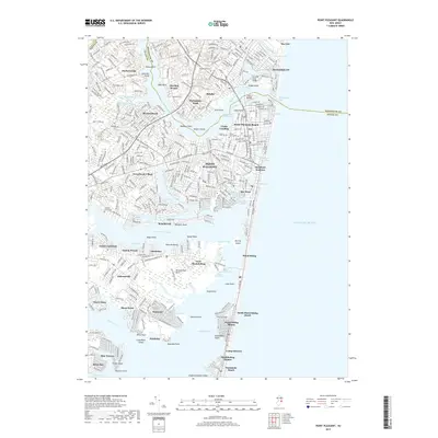
2019 Map of Point Pleasant
USGS Topo · Published 2019About this map
The Manasquan River and the Point Pleasant Canal dominate this coastal landscape, illustrating the intricate hydraulic connection between the Atlantic Ocean and the sprawling waters of Barnegat Bay. The 2019 survey delineates a highly developed shorefront where the boundary between Monmouth Co and Ocean Co meets at the Manasquan Inlet. Dense residential patterns characterize established communities like Point Pleasant and Brielle, while smaller neighborhoods such as Adamston and Mandalay occupy the various necks and points along the Metedeconk River.
Find a feature on this map
86 named features on this map. Tap any name to fly to it.
Don’t see what you’re looking for? This feature index may not catch every label — zoom into the map to look around manually.
Map Details
Editions of this 2019 Point Pleasant Map
This is the sole edition of this map. No revisions or reprints were ever made.
Other maps of this area

1888 · Barnegat
USGS Topo · 1:62,500

1888 · Asbury Park
USGS Topo · 1:62,500

1893 · Asbury Park
USGS Topo · 1:62,500

1893 · Barnegat
USGS Topo · 1:62,500

1898 · Barnegat
USGS Topo · 1:62,500

1901 · Asbury Park
USGS Topo · 1:62,500

1902 · Navesink
USGS Topo · 1:125,000

1919 · Barnegat
USGS Topo · 1:62,500

1919 · Asbury Park
USGS Topo · 1:62,500

1941 · Toms River
USGS Topo · 1:62,500