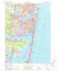
2023 Map of Point Pleasant
USGS Topo · Published 2023About this map
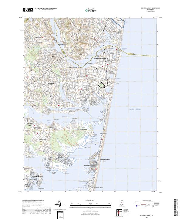
Barnegat Bay and the Atlantic Ocean converge at this densely charted portion of the Jersey Shore, where the Point Pleasant Canal provides a critical link between the Manasquan River and the northern bay. The landscape is defined by its intricate water-land interface, featuring named points like Turkey Point and Wardells Neck alongside developed coastal communities from Brielle and Point Pleasant Beach down to Mantoloking. Inland, the map reveals the residential patterns of neighborhoods such as Herbertsville and Adamston, while local heritage is anchored by sites like Gravelly Graveyard and White Lawn Cem. The density of named coves and thoroughfares, such as Wills Hole Thoroughfare and Havens Cove, reflects a maritime environment where every inlet and island, including Herring Island and Middle Sedge, is vital to local navigation and identity.
Find a feature on this map
94 named features on this map. Tap any name to fly to it.
Don’t see what you’re looking for? This feature index may not catch every label — zoom into the map to look around manually.
Map Details
Editions of this 2023 Point Pleasant Map
This is the sole edition of this map. No revisions or reprints were ever made.
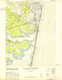
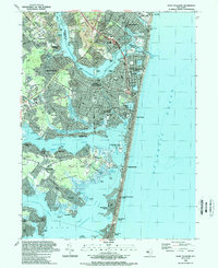
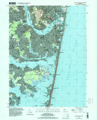
Historical Maps of Camp Osborne Through Time
5 maps found