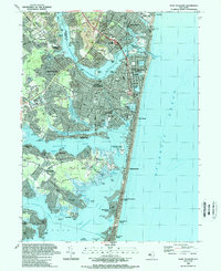
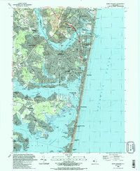
1989 Map of Point Pleasant
USGS Topo · Published 1989About this map
The Manasquan River and Metedeconk River define the intricate coastline of this late-20th-century Jersey Shore survey. Between the river mouths lies a dense network of coastal communities, from the borough of Point Pleasant Beach to the narrow barrier island settlements of Mantoloking and Bay Head. The map illustrates the complex hydrology of the Barnegat Bay region, where tidal basins like Lake Louise and the Little Silver Lake are separated from the Atlantic Ocean by a thin, heavily developed strand.
Find a feature on this map
105 named features on this map. Tap any name to fly to it.
Don’t see what you’re looking for? This feature index may not catch every label — zoom into the map to look around manually.
Map Details
Editions of this 1989 Point Pleasant Map
2 editions found
Other maps of this area

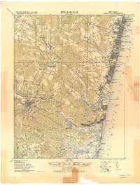
1888 · Barnegat
USGS Topo · 1:62,500

1888 · Asbury Park
USGS Topo · 1:62,500

1893 · Asbury Park
USGS Topo · 1:62,500

1893 · Barnegat
USGS Topo · 1:62,500

1898 · Barnegat
USGS Topo · 1:62,500

1901 · Asbury Park
USGS Topo · 1:62,500

1902 · Navesink
USGS Topo · 1:125,000

1919 · Barnegat
USGS Topo · 1:62,500
1919 · Asbury Park
USGS Topo · 1:62,500

1941 · Toms River
USGS Topo · 1:62,500