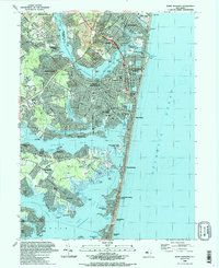
1989 Map of Point Pleasant
USGS Topo · Published 1989About this map
Metedeconk River and the Manasquan River dominate this coastal landscape at the northern reach of Barnegat Bay. In the late 1980s, the dense suburbanization of Ocean County is evident in the intricate canal systems of Shore Acres, Baywood, and Mantoloking Shores. The map documents a maritime economy transitioning into a recreation-focused shore community, centered around the Manasquan Inlet and the Intracoastal Waterway. Landmarks of local heritage include the Abbie Town Cem, St Paul Ch, and the rail terminus at Bay Head Junction. Large protected zones like the Swan Point State Natural Area and Manasquan River State Wildlife Mgmt Area provide a sharp contrast to the developed residential grids of Point Pleasant and Brielle, preserving the natural shoreline of the Jersey Shore before further modernization.
Find a feature on this map
109 named features on this map. Tap any name to fly to it.
Don’t see what you’re looking for? This feature index may not catch every label — zoom into the map to look around manually.
Map Details
Editions of this 1989 Point Pleasant Map
2 editions found
Other maps of this area

1888 · Barnegat
USGS Topo · 1:62,500

1888 · Asbury Park
USGS Topo · 1:62,500

1893 · Asbury Park
USGS Topo · 1:62,500

1893 · Barnegat
USGS Topo · 1:62,500

1898 · Barnegat
USGS Topo · 1:62,500

1901 · Asbury Park
USGS Topo · 1:62,500

1902 · Navesink
USGS Topo · 1:125,000

1919 · Barnegat
USGS Topo · 1:62,500

1919 · Asbury Park
USGS Topo · 1:62,500

1941 · Toms River
USGS Topo · 1:62,500