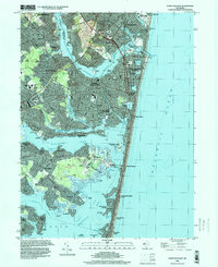
1995 Map of Point Pleasant
USGS Topo · Published 2000About this map
The Manasquan River and Metedeconk River dominate this coastal landscape, carving out a complex geography of points and coves before opening into Barnegat Bay. In the mid-1990s, the area shows a dense maritime and residential character, from the developed waterfronts of Point Pleasant and Bay Head to the narrow barrier peninsula of Mantoloking. The map captures the intersection of recreational and industrial history, featuring the Point Pleasant State Marina alongside inland Gravel Pits and the Bay Head Junction rail terminal.
Find a feature on this map
103 named features on this map. Tap any name to fly to it.
Don’t see what you’re looking for? This feature index may not catch every label — zoom into the map to look around manually.
Map Details
Editions of this 1995 Point Pleasant Map
This is the sole edition of this map. No revisions or reprints were ever made.
Other maps of this area

1888 · Barnegat
USGS Topo · 1:62,500

1888 · Asbury Park
USGS Topo · 1:62,500

1893 · Asbury Park
USGS Topo · 1:62,500

1893 · Barnegat
USGS Topo · 1:62,500

1898 · Barnegat
USGS Topo · 1:62,500

1901 · Asbury Park
USGS Topo · 1:62,500

1902 · Navesink
USGS Topo · 1:125,000

1919 · Barnegat
USGS Topo · 1:62,500

1919 · Asbury Park
USGS Topo · 1:62,500

1941 · Toms River
USGS Topo · 1:62,500