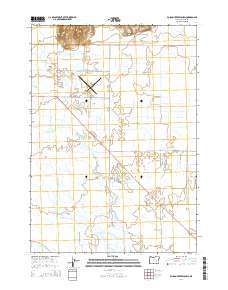
2014 Map of Poison Creek Slough
USGS Topo · Published 2014About this map
East Fork Silvies River meanders through this Harney County landscape, defining a complex network of waterways that once supported the region's agricultural development. The terrain is characterized by numerous seasonal channels and bypasses, including Poison Creek Slough, Embree Slough, and Foley Slough, which weave between historical township boundaries. Aviation history is centered at the Burns Municipal Airport, a prominent landmark situated just north of the junction of Or-78 and Airport Lane. To the north, the elevation rises toward Sand Hill, providing a geographic anchor overlooking the flatter basin where the Upper Hanley Canal and other irrigation works distribute water across the valley. A grid of rural roads like Old Experiment Road and Rye Grass Lane reflects the organized land use and settlement patterns of this high desert environment.
Find a feature on this map
25 named features on this map. Tap any name to fly to it.
Don’t see what you’re looking for? This feature index may not catch every label — zoom into the map to look around manually.
Map Details
Editions of this 2014 Poison Creek Slough Map
This is the sole edition of this map. No revisions or reprints were ever made.
Other maps of this area

1955 · Burns
USGS Topo · 1:250,000

1958 · Burns
USGS Topo · 1:250,000

1959 · Burns
USGS Topo · 1:250,000

1959 · Harney
USGS Topo · 1:62,500

1959 · Dog Mountain
USGS Topo · 1:62,500

1959 · Lawen
USGS Topo · 1:62,500

1960 · Burns
USGS Topo · 1:62,500

1960 · Burns
USGS Topo · 1:24,000

1975 · Burns
USGS Topo · 1:24,000

1978 · Malheur Lake
USGS Topo · 1:100,000