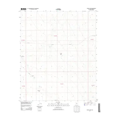
2013 Map of Polecat Tank
USGS Topo · Published 2013About this map
The arid high-desert landscape of the Jornada del Muerto basin is defined by its scarce water sources and expansive ranching territory. Centered on the Jornada Draw, this terrain is punctuated by essential water catchments such as Polecat Tank, Sand Tank, and East Pasture Tank, which are critical infrastructure for the region's livestock operations. The presence of Rainwater Ranch in the southwestern quadrant provides a specific point of human settlement amidst the vast topography, connected to the wider area by remote thoroughfares like CO Road A-23. In the southern reaches, the drainage of McLenden Draw and the outlier Antelope Tank further illustrate the sparse but vital water management network that has historically enabled life and commerce in this section of Sierra County.
Find a feature on this map
16 named features on this map. Tap any name to fly to it.
Don’t see what you’re looking for? This feature index may not catch every label — zoom into the map to look around manually.
Map Details
Editions of this 2013 Polecat Tank Map
This is the sole edition of this map. No revisions or reprints were ever made.
Other maps of this area

1916 · Tonuco
USGS Topo · 1:125,000

1916 · Salinas Peak
USGS Topo · 1:125,000

1932 · Tonuco
USGS Topo · 1:125,000

1948 · Sowell
USGS Topo · 1:62,500

1948 · Chicken Well
USGS Topo · 1:62,500

1954 · Tularosa
USGS Topo · 1:250,000

1955 · Las Cruces
USGS Topo · 1:250,000

1958 · Las Cruces
USGS Topo · 1:250,000

1958 · Tularosa
USGS Topo · 1:250,000

1959 · Engle
USGS Topo · 1:62,500