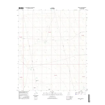
2017 Map of Polecat Tank
USGS Topo · Published 2017About this map
Spaceport America stands as a modern anchor in this expansive Sierra County landscape, positioned near the drainage of Jornada Draw. The terrain is defined by a network of ranching infrastructure and utility corridors, where ephemeral water sources like Sand Tank and East Pasture Tank supported livestock across the high desert floor. The map documents the spatial relationship between traditional land use, represented by features like McLenden Draw and Polecat Tank, and contemporary infrastructure. A grid of local roads, including Sowell Rd and Co Rd 22, provides access through the various township and range sections. The presence of both a Pipeline Rd and a Powerline Rd underscores the area's role as a transit corridor for regional energy and technology resources in the early 21st century.
Find a feature on this map
20 named features on this map. Tap any name to fly to it.
Don’t see what you’re looking for? This feature index may not catch every label — zoom into the map to look around manually.
Map Details
Editions of this 2017 Polecat Tank Map
This is the sole edition of this map. No revisions or reprints were ever made.
Other maps of this area

1916 · Tonuco
USGS Topo · 1:125,000

1916 · Salinas Peak
USGS Topo · 1:125,000

1932 · Tonuco
USGS Topo · 1:125,000

1948 · Sowell
USGS Topo · 1:62,500

1948 · Chicken Well
USGS Topo · 1:62,500

1954 · Tularosa
USGS Topo · 1:250,000

1955 · Las Cruces
USGS Topo · 1:250,000

1958 · Las Cruces
USGS Topo · 1:250,000

1958 · Tularosa
USGS Topo · 1:250,000

1959 · Engle
USGS Topo · 1:62,500