2024 Map of Pollard
USGS Topo · Published 2024About this map
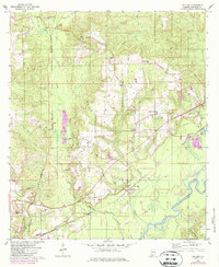
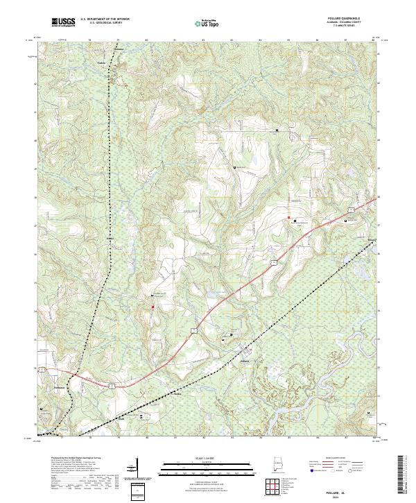
The Conecuh River and Little Escambia Creek define this section of Escambia County, where water and wood have long shaped the settlement patterns of southern Alabama. The village of Pollard remains a central point of interest, surrounded by a dense concentration of family and community burial grounds including the Pollard Cem and Hillcrest Cem. Further south, the map reveals smaller named localities such as Welka and Wahl, while the northern reaches transition into the drainage basins of Wild Fork Creek and Foshee.
Find a feature on this map
106 named features on this map. Tap any name to fly to it.
Don’t see what you’re looking for? This feature index may not catch every label — zoom into the map to look around manually.
Map Details
Editions of this 2024 Pollard Map
This is the sole edition of this map. No revisions or reprints were ever made.