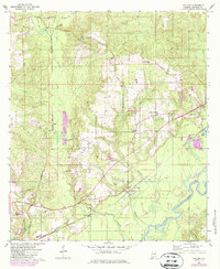
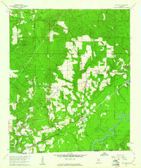
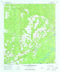
1960 Map of Pollard
USGS Topo · Published 1987About this map
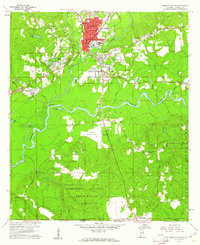
Pollard and Flomaton anchor this 1960s survey of southern Escambia County, where the Conecuh River meanders through bottomlands near the Florida border. The landscape is defined by its complex network of waterways, including Little Escambia Creek and Chavers Creek, which supported early regional infrastructure like the Jernigan Mill Creek. The Seaboard rail line provides a transit spine connecting small community hubs like Osaka, Wahl, and Keego.
Find a feature on this map
40 named features on this map. Tap any name to fly to it.
Don’t see what you’re looking for? This feature index may not catch every label — zoom into the map to look around manually.
Map Details
Editions of this 1960 Pollard Map
3 editions found
Other maps of this area

1941 · Century
USGS Topo · 1:62,500

1943 · Century
USGS Topo · 1:62,500

1943 · Jay
USGS Topo · 1:62,500

1953 · Andalusia
USGS Topo · 1:250,000

1957 · Andalusia
USGS Topo · 1:250,000

1957 · Pensacola
USGS Topo · 1:250,000

1959 · Pensacola
USGS Topo · 1:250,000
1959 · Brewton South
USGS Topo · 1:24,000

1960 · Pensacola
USGS Topo · 1:250,000
1960 · Brewton South
USGS Topo · 1:24,000