
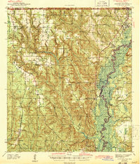
1943 Map of Century
USGS Topo · Published 1943About this map
The Escambia River defines the eastern boundary of this 1940s landscape, where its winding course creates a complex network of wetlands and islands like Parker Island. This era captures the dual rail corridor of the Florida panhandle, featuring the Louisville and Nashville and St Louis San Francisco lines which shaped the growth of timber and agricultural hubs. In the western reaches, Walnut Hill and McDavid serve as local centers, while the interior is dotted with rural social anchors such as Ward Sch and Rays Chapel. The presence of sites like Coon Hill Cem and Oak Grove Cem offers significant value for genealogists tracing family roots in this riverine borderland. The terrain transitions from the well-drained heights of Sugar Hill Ch down to the bottomlands near Chumuckla Springs.
Find a feature on this map
64 named features on this map. Tap any name to fly to it.
Don’t see what you’re looking for? This feature index may not catch every label — zoom into the map to look around manually.
Map Details
Editions of this 1943 Century Map
2 editions found
Other maps of this area

1920 · Milton
USGS Topo · 1:62,500

1920 · Robertsdale
USGS Topo · 1:62,500

1921 · Muscogee
USGS Topo · 1:62,500

1941 · Muscogee
USGS Topo · 1:62,500

1941 · Robertsdale
USGS Topo · 1:62,500

1941 · Milton
USGS Topo · 1:62,500

1941 · Century
USGS Topo · 1:62,500

1942 · Perdido
USGS Topo · 1:62,500

1942 · Dyas
USGS Topo · 1:62,500

1943 · Robertsdale
USGS Topo · 1:62,500