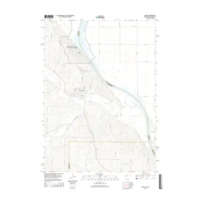
2014 Map of Ponca
USGS Topo · Published 2014About this map
Ponca serves as a focal point in Dixon County where the Nebraska bluffs meet the expansive Missouri River valley. This 2014 survey captures the landscape at a point where the Missouri National Recreational River corridor preserves the natural character of the waterway as it forms the state boundary with South Dakota. The town's layout is clearly defined, with streets like N Nebraska St and N Court St radiating from the center, while the Ponca Cem sits atop the higher ground to the north.
Find a feature on this map
52 named features on this map. Tap any name to fly to it.
Don’t see what you’re looking for? This feature index may not catch every label — zoom into the map to look around manually.
Map Details
Editions of this 2014 Ponca Map
This is the sole edition of this map. No revisions or reprints were ever made.
Other maps of this area

1898 · Elk Point
USGS Topo · 1:125,000

1901 · Elk Point
USGS Topo · 1:125,000

1907 · Elk Point
USGS Topo · 1:125,000

1955 · Sioux City
USGS Topo · 1:250,000

1958 · Sioux City
USGS Topo · 1:250,000

1959 · Sioux City
USGS Topo · 1:250,000

1963 · Elk Point
USGS Topo · 1:24,000

1963 · Elk Point NE
USGS Topo · 1:24,000

1963 · Jefferson
USGS Topo · 1:24,000

1964 · Burbank
USGS Topo · 1:24,000
Featured Places
- Ponca, NE
- Civil Bend Township, SD
- McKays Trailer Court, SD
- Hoffmans Trailer Court, SD
- Ottercreek Township, NE